
Noxious Weed Monitoring
Empowering Park County and Beyond: Our Healthy Lands Program
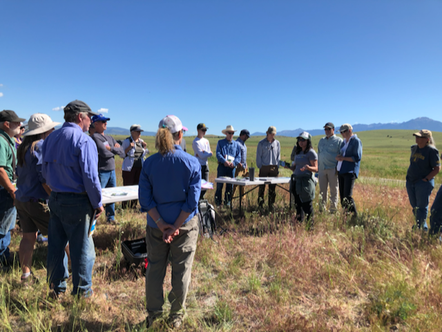
In 2022, PCEC launched a collaborative invasive weed monitoring and education project with local partners: Park County CWMA, MSU Extension, County Weed District, Park CD, and NRCS. Our program utilizes established protocols and data analysis methods that align with state and national standards to test efficacy of invasive species mitigation.
Our goal is to equip Park County landowners and community members with the knowledge and tools to effectively manage noxious weeds and promote resilient plant communities. By collecting and analyzing treatment data, we're contributing to a broader understanding of weed control, grazing practices, and rangeland health.
Our program Model and tools Are now being shared statewide in partnership with Montana Department of Agriculture, Montana State University, and the Noxious Weed Trust Fund with the developemnt of the Montana Noxious Weed Monitoring Toolbox.
This user-friendly toolbox includes a field app survey, training resources, and guidance on data storage, analysis, and dissemination. Our locally driven initiative is now making a significant impact at both the county and state levels.
Addressing Local Landscape Challenges: Our Commitment to Resilience
As our region faces increasing threats from drought, wildfire, and floods, our primary goal is to empower local communities with knowledge and resources for sustainable land management. We provide technical assistance, connect people with local resources, and foster strong partnerships.
We understand that there are no easy solutions when it comes to managing noxious weeds. That's why we focus on promoting resilient plant communities and healthy soils. We're dedicated to providing Park County residents and land managers with the tools, research, and alternative methods they need, including biocontrol and revegetation projects.


"We educate the local community about alternative invasive species management methods and make them more accessible to agricultural producers and landowners."
Did you know that bugs can help with your weeds?
Biocontrol is a sustainable approach to invasive species management that utilizes natural predators, such as insects or fungi, to reduce their populations. Unlike native plants, which are often kept in check by natural balances, invasive species can disrupt ecosystems due to their lack of native predators. By introducing carefully selected biocontrol agents, we can help to weaken invasive plants and create opportunities for native species to thrive. This approach helps to restore ecological balance and reduce the repeated use of costly and potentially harmful chemical interventions.


Rigorus Research The use of biocontrol agents is a carefully regulated and scientifically supported approach to invasive species management. In general is take more the 10 years for a biocontrol agent to be appoved for release in the United States. While long-term predictions are difficult, the potential risks associated with biocontrol are generally considered to be lower than those associated with chemical control. By investing in research and rigorous testing, we can ensure that biocontrol agents are used responsibly and effectively to protect our ecosystems.
Long-Term Impacts of Biocontrol and Chemical Control While it is challenging to predict the long-term impacts of biocontrol agents over a 1000-year timescale, the process of rigorous testing and regulation is designed to minimize risks to native ecosystems. Biocontrol agents are often more targeted than chemical controls, reducing the potential for unintended consequences.
In contrast, the long-term impacts of chemical control are more predictable. Chemicals can persist in the environment for many years, contaminating water sources, harming wildlife, and contributing to soil degradation. Over a 1000-year timescale, the cumulative effects of chemical use could be significant and irreversible.
Our Work We collaborate with local organizations, including Park County Weed District, MSU Extension, and our local Cooperative Weed Management Area, to collect, distribute, and monitor biocontrol agents. Our goal is to provide landowners with a sustainable and effective alternative to traditional weed control methods.
Through partnerships with Ecology Project International and the Montana Biocontrol Collaboration Project, we are conducting rigorous monitoring and research to ensure the efficacy and safety of biocontrol programs. We are also working to establish local collection sites to support ongoing efforts and advance the field of biocontrol.
Frequently Asked Questions
Frequently Asked Questions
What is "weed mapping"?
Weed mapping, or inventorying, tracks the location and density of weed infestations. This information helps identify priority areas and plan effective treatments. Integrated weed management is the best approach, combining various methods like biocontrol, herbicides, and hand pulling based on specific conditions. Weed mapping simplifies this process.
We're currently conducting a Yellowstone River Pre & Post Noxious Weed Inventory to understand the 2022 flood's impact on riparian vegetation.
How can I map weeds on my property or public lands?
EDDMapS is a user-friendly weed mapping tool used throughout Montana. It helps private and public land managers track and monitor weeds. It's also an early detection and rapid response (EDRR) tool, crucial for preventing weed spread. Learn more about EDRR programs and Montana's weeds here.
Do you map other species of interest?
Yes, we map other plant species. While weeds are a focus, we also track desirable plants. For example, we're mapping post flood recovery of cottonwood along the Yellowstone River to protect these ecologically important sites. In addition, we look for species of concern in Montana like beargrass, glacier lily, McDonald's rock-cress, and Gentner's fritillary.

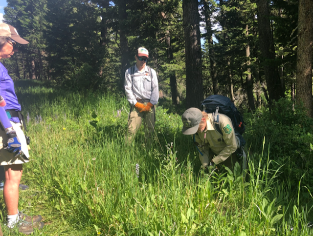
What is "treatment monitoring"?
Noxious weed treatment monitoring tracks the effectiveness of weed control methods over time. By understanding the effects on both noxious weeds and native plant communities, we can make informed land management decisions and improve wildlife habitat and forage.
What should participants expect?
Map infested areas
Share treatment history and plans
Establish permanent plots for annual sampling
Gain insights into treatment effectiveness and vegetation response
Want to stay informed or get involved?
Go to the PCEC events page to see what we’re planning next, or contact Bethany for volunteer opportunities.