Extended Comment Period: Bear Palmer Forest Health (Logging) Project
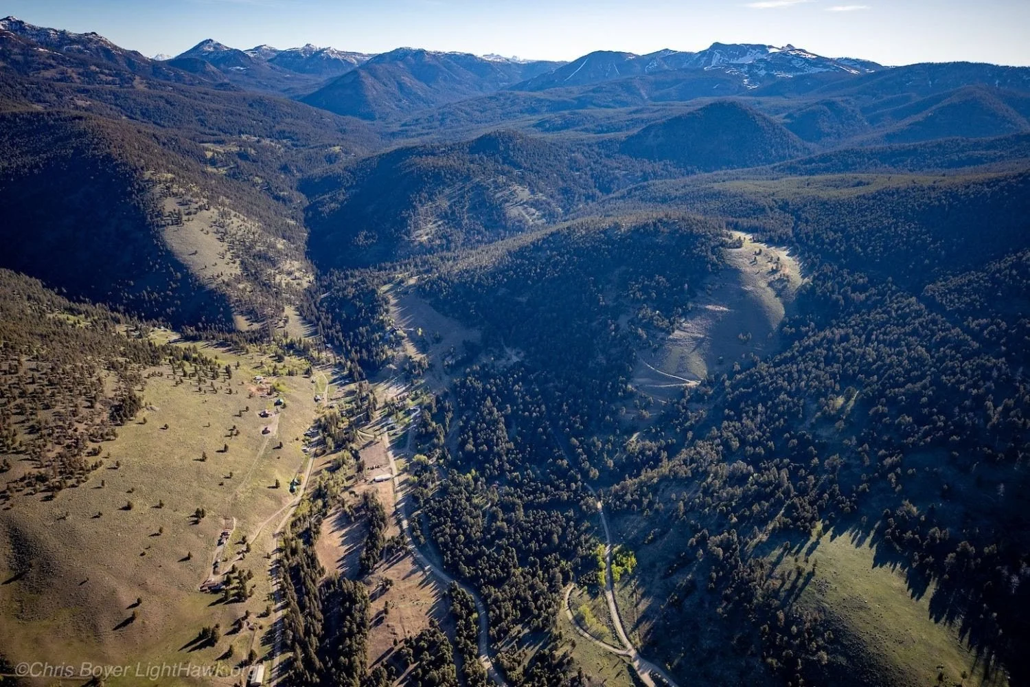
Arial view of the community of Jardine. Photo courtesy Chris Boyer and Lighthawk
Due to public request, the U.S. Forest Service has extended the comment period for the proposed Bear Palmer Forest Health Project through June 1, 2026. While extra time is welcome, the current framework is deeply constrained and this is our only chance to shape the outcome.
We are being asked to evaluate a project in its infancy while buried under mountains of data. Yet, the Environmental Assessment is still pending, the Preliminary Effects Document and maps are incomplete and ground access to many treatment units are blocked until mid-June, after the comment window closes.
Because this process is bound by federal "emergency" fast-track authorities, the standard, rigorous review timelines we rely on have been severely shortened, limiting our traditional avenues for community input. Consequently, we are working overtime—meeting with partners, consulting neighbors, and digging through data—to make sense of the moving targets.
Despite these challenges, we are sharing our initial findings and the critical issues you need to know to help formulate your own unique public comments.
Initial Findings and Critical Issues
Timeline - While appreciated, the extended timeline is still inadequate for meaningful review. A 30-day window during spring conditions means that much of the project terrain remains inaccessible due to snow and closed gates. Other data has also been delayed: unit and wildlife maps used during the April 30th meeting weren’t released until May 1st, and we did not receive the treatment GIS files until May 12th. We are still waiting on essential datasets regarding historical harvests, white bark pine surveys, and additional wildlife data.
Wildlife - The project area sits on the boundary of Yellowstone National Park and the adjacent Absaroka–Beartooth Wilderness. But Yellowstone is not an island. Introducing heavy machinery and extensive clearcutting to this border directly threatens critical habitat for Endangered Species Act protected species, including Canada lynx, grizzly bears, wolverines, and whitebark pine. Preserving this intact ecosystem is essential not just for these threatened species, but for the entire web of wildlife that depends on it. Unfortunately, the preliminary materials downplay impacts on winter habitat and migration corridors, while providing no requirements or funding to mitigate the guaranteed spread of noxious weeds. While we are encouraged by goals to enhance aspen communities, reduce conifer encroachment in riparian zones, and regenerate whitebark pine, the current plan leaves it highly uncertain how these will be effectively achieved.
Economy - The preliminary economic analysis falls short, it reduces value strictly to timber feasibility and regional mill infrastructure. It completely overlooks the distinct, recreation-driven economies of Gardiner, Jardine, and broader Park County, leaving out the very communities closest to the project area. In 2024, non-resident tourism brought $294.4 million into Park County. Data from the University of Montana’s Institute for Tourism and Recreation Research shows some of our primary economic drivers are day hiking (44%) and wildlife watching (30%). Proposing commercial logging directly along popular trailheads and campgrounds risks recreational closures that will harm local businesses like restaurants, grocery stores, and guiding services. Additionally, the visual footprint of clearcuts will mar the iconic gateway views from the Roosevelt Arch in Gardiner. With active logging projects potentially spanning up to 10 years, local roads, public safety, and tourist retention will be compromised.
Access & Public Safety - The Preliminary Effects Document fails to safely account for transportation impacts on local infrastructure. Jardine is an isolated community accessed exclusively by a single, steep gravel road with only one way in and one way out. Introducing heavy logging machinery and timber truck traffic onto this narrow corridor creates immediate, severe safety hazards for residents, recreational users, and visitors traveling to Yellowstone, with spillover traffic impacts extending into Gardiner and along Highway 89. Furthermore, it remains unclear who will cover the substantial costs to repair county roads already in disrepair.
Riparian Areas - The Preliminary Effects Document skips pre-construction baseline measurements for sediment loads, turbidity, streambed embeddedness, and channel morphology in Bear, Eagle, Palmer, and Crevice Creeks. Without this data, it is impossible to accurately monitor for harm or guarantee compliance with the Clean Water Act. This missing baseline represents a critical gap in project planning, especially given the proposed 7.7 miles of new permanent roads and 16.9 miles of temporary roads cut into steep terrain, which are the exact types of impervious surfaces known to drive devastating sediment runoff into trout and wildlife streams. How can the Forest Service track environmental damage if they don't establish a starting baseline?
Wildfire Risk & Insect Outbreaks - Attempting mechanical treatments in a massive, connected ecosystem like the Greater Yellowstone, to stop a climate-driven wildfire and insect outbreaks, seems like treating fruit flies on a single cherry tree in an endless orchard. The project area is eclipsed by Yellowstone and the ABWilderness, both of which prioritize natural ecological processes. While this project is framed as "forest health," commercial logging and clearcutting can actually increase severe fire risk by drying out the forest floor, increasing ground winds, and leaving behind highly flammable logging slash. While we support fuels reduction and prescribed fire when done in partnership with the community, a far more effective investment of millions in federal funding would be to support home hardening, establish defensible space, and directly fund our rural fire departments. Along with adjacent counties, Park County is currently updating its Community Wildfire Protection Plan (CWPP). Because a CWPP is explicitly designed to map wildfire hazards, identify effective mitigation strategies, and influence how federal land is managed for risk reduction, it is counterintuitive for the Forest Service to rush the Bear Palmer project ahead of this update rather than using the CWPP itself as the primary collaborative tool to achieve these shared goals.
Contradictions and Discrepancies - There is not sufficient data for the public to weigh in properly and we are still uncertain what qualifies this area for emergency action. The preliminary materials openly state that treatment boundaries, clearcut acreages, and road placements are only "approximate estimates" that will be "refined based on field conditions" during the timber sale execution. The Forest Service is asking for public feedback on a moving target. By leaving boundaries to the discretion of logging contractors later on, and impacts dependent on available resources like noxious weed mitigation, anything can happen after the comment window closes, erasing public transparency. Additionally, the extension of the comment period underscores that a thorough analysis takes time, signaling that the project would benefit far more from a standard NEPA process rather than stripping citizens of their traditional administrative objection rights.
A Better Way Forward: True Collaboration, Not Top-Down Mandates
We deeply appreciate the Gardiner Ranger District team for extending the deadline and hosting informational meetings to walk us through the data. We want to build on that goodwill by designing proactive forest health projects together, but the current, fast-tracked federal framework doesn't allow for the true collaboration our community is asking for.
Across the West, successful collaborations like the Colt Summit Project demonstrate that bringing diverse voices to the table, including conservationists, local residents and land owners, tribal nations, and scientists leads to durable, long-term community-supported wildfire mitigation solutions. We want to see a similar collaborative framework applied here. While it takes time, patience and persistence, community driven democracy is vital and the best time to start is now.
As we continue to review the data and once the snow melts enough for us to walk more of the project area, we will provide more ideas on how we think a forest health project could benefit this landscape.
In the meantime, we will continue to urge the Forest Service to reconsider this rushed process and pivot to working alongside our community. To protect our homes, livelihoods and wild ecosystems, we must move beyond simple opposition and challenge this project with unique, substantive comments that address the goals of forest health. Your firsthand perspective is what makes our collective voice impossible to ignore.
Submit your comment today, encourage others to do the same, and ensure our community's voice is part of the official record. Click below to comment and to learn more.
Project Overview
The Gardiner Ranger District is proposing to treat approximately 4,401 acres of National Forest Service lands surrounding the community of Jardine.
2,126 acres are poised for commercial logging, including 824 acres of clearcutting, 802 acres of commercial thinning, and 500 acres of group tree removals
2,275 acres are designated for non-commercial treatments, including 1,440 acres of hand-thinning, 565 acres of small-tree thinning, and 260 acres of prescribed fire burns.
This project is being fast-tracked as an emergency action under the 2021 Infrastructure Investment and Jobs Act, and the standard administrative review and objection processes we are accustomed to have been eliminated.
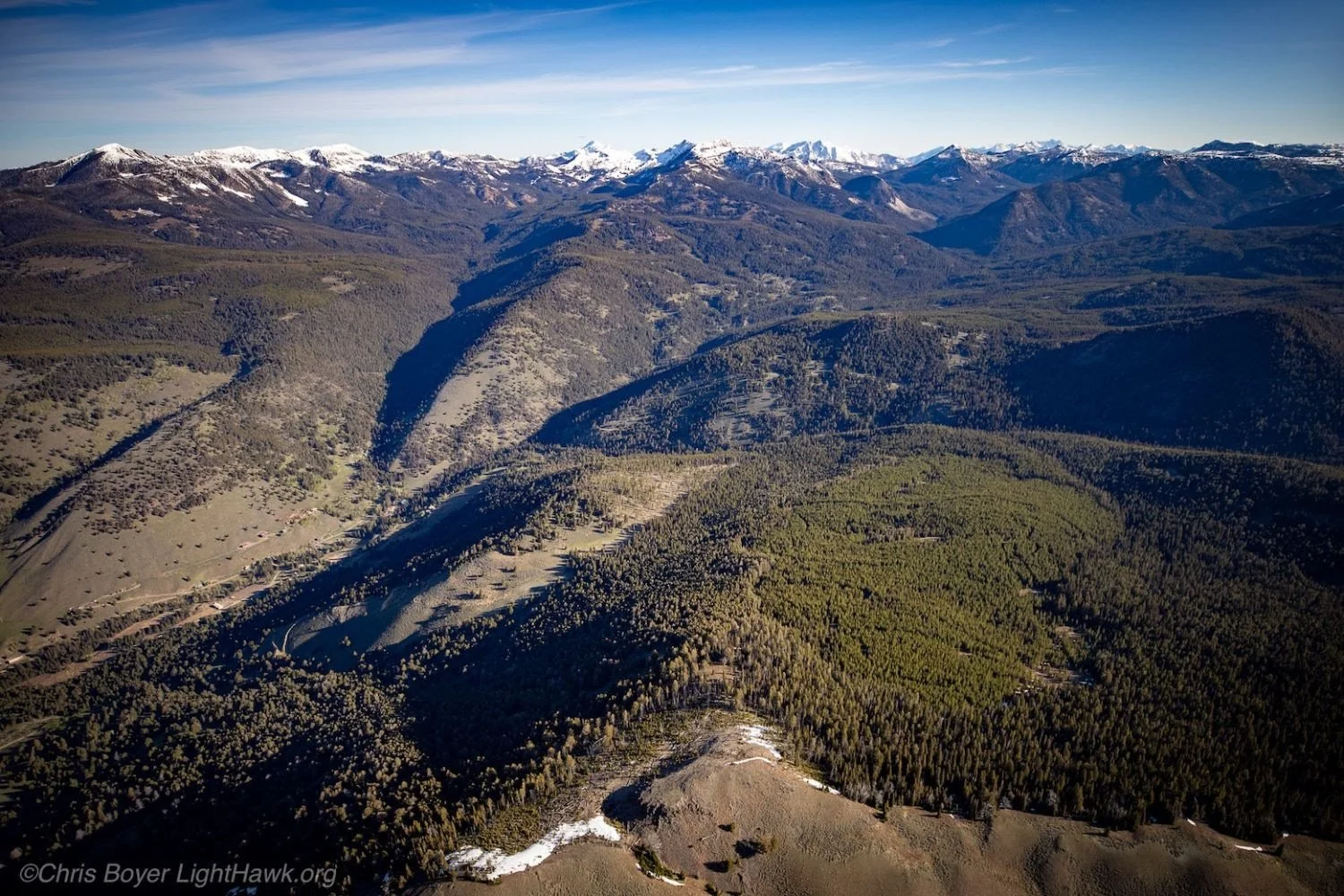
Ariel view of a section of the proposed project area. Photo courtesy Chris Boyer and Lighthawk